Hurricane Matthew was a near miss, so after a couple days of hunkering down, sunny skies and calm conditions required us to catch up on our beach time.
We walked the western side of the Chesapeake Bay where it meets the Atlantic. While enjoying the solitude of a beach almost to ourselves there were signs beach erosion.
All ours:
This was formerly a path down to the beach. Now the last step is a drop off.
How about a million dollar beach home and your stairs down to the beach ends in mid air.
Yesterday we drove over to Virginia Beach to walk the boardwalk. At the mid-point this large sculptural rendition of Poseidon.
Friday, October 14, 2016
Sunday, October 9, 2016
Water front property
It was a near miss with hurricane Matthew, but still a couple days of excitement.
A few brief power outages, high winds stripping leaves from the trees, and lots of torrential rain has left the street in front of our house more suitable for kayaking rather than driving. I had to discourage De Anne from launching her kayak off the driveway with horror stories of what might lurk in the waters.
We now fully appreciate the house sitting on high ground and the driveway that has a sharp upward slope,
8:00 am Sunday morning;
Wednesday, October 5, 2016
High tide
We are settled in Virginia Beach VA, or more specifically Chic's Beach near the Kellam Bridge/Tunnel. We are a block from the ocean and if predictions for Hurricane Matthew pan out that might be more than close enough.
Although high winds, clouds, and the threat of rain discouraged us from a morning beach walk today, when we saw the high surf advisory we had to see for ourselves. Our first beach walk (sans pictures) on Saturday was benign. Gentle waves lapping a 10 to 20 yard wide stretch of sand.
Pictures 1 and 2 were taken at high tide yesterday and pictures 3 and 4 are similar angles from today.
The next day
Sunday, October 2, 2016
3 ferrys and 2 lighthouses
Our next stop for the month of October is Virginia Beach and we could have driven the whole way; but, what fun is that?
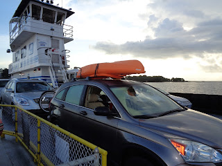
My intrepid wife plotted our course over land and water starting with the Cherry Point ferry. I sighed and then I rolled my eyes. She just smiled, because she knew which way we we going and the pictures below proved she was right.
All of our worldly goods in one picture:
A one hour cross-island dash put us on the Cedar Island ferry. A $15 poor man's cruise of 2 1/2 hours to Ocracoke Island.
From the upper deck:
Ending the day on a high note - the magnificent Hatteras lighthouse:
My intrepid wife plotted our course over land and water starting with the Cherry Point ferry. I sighed and then I rolled my eyes. She just smiled, because she knew which way we we going and the pictures below proved she was right.
All of our worldly goods in one picture:
A one hour cross-island dash put us on the Cedar Island ferry. A $15 poor man's cruise of 2 1/2 hours to Ocracoke Island.
From the upper deck:
A storm chasing us the whole way:
The somewhat uninspiring Ocracoke lighthouse:
The third and final ferry of the day to Hatteras Island. Note all our goods still intact:
Subscribe to:
Comments (Atom)


